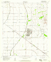
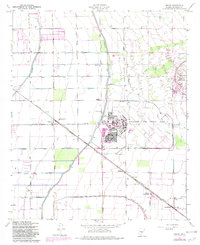
1956 Map of Higley
USGS Topo · Published 1959About this map
Williams Air Force Base dominates the center of this mid-1950s Arizona landscape, showcasing a massive military footprint complete with a Golf Course, Willie Park, and a complex grid of base housing. The surrounding territory is defined by an intensive irrigation infrastructure including the Eastern Canal and Roosevelt Canal, which support the agricultural development of Maricopa County. The Southern Pacific Rittenhouse railroad line cuts diagonally through the sheet, linking the small settlement of Higley and its nearby Higley Sch to the rural outpost at Rittenhouse. To the southeast, the Arizona Boys Ranch and Queen Creek Sch near the banks of Queen Creek indicate the steady growth of social and educational institutions in this desert environment. The presence of the Desert Proving Grounds in the northeast further highlights the region's importance for military testing and development during this era.
Find a feature on this map
31 named features on this map. Tap any name to fly to it.
Don’t see what you’re looking for? This feature index may not catch every label — zoom into the map to look around manually.
Map Details
Editions of this 1956 Higley Map
5 editions found
Other maps of this area

1904 · Desert Well
USGS Topo · 1:62,500

1906 · Desert Well
USGS Topo · 1:62,500

1907 · Sacaton
USGS Topo · 1:62,500

1913 · Mesa
USGS Topo · 1:62,500

1914 · Gila Butte
USGS Topo · 1:62,500

1915 · Mesa
USGS Topo · 1:62,500

1917 · Gila Butte
USGS Topo · 1:62,500

1952 · Chandler
USGS Topo · 1:24,000
1952 · Mesa
USGS Topo · 1:24,000

1952 · Gila Butte
USGS Topo · 1:24,000