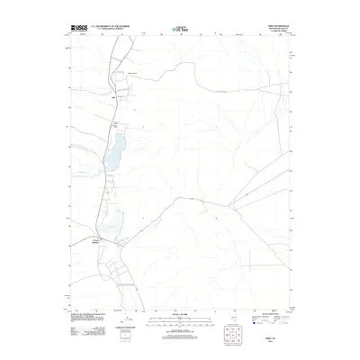
2012 Map of Hiko
USGS Topo · Published 2012About this map
Hiko Spring and the surrounding basin define this Lincoln County landscape, where water has long dictated the patterns of settlement and ranching. The presence of Nesbitt Lake and Frenchy Lake south of the main Hiko community highlights the critical role of these terminal basins in an otherwise arid environment. Along the western edge of the valley, the Hiko Post Office serves as the hub for local rural life, situated near family-named landmarks like Nesbitt Ranch.
Find a feature on this map
19 named features on this map. Tap any name to fly to it.
Don’t see what you’re looking for? This feature index may not catch every label — zoom into the map to look around manually.
Map Details
Editions of this 2012 Hiko Map
This is the sole edition of this map. No revisions or reprints were ever made.
Other maps of this area

1945 · Alamo
USGS Topo · 1:125,000

1954 · Caliente
USGS Topo · 1:250,000

1959 · Caliente
USGS Topo · 1:250,000

1969 · Alamo NE
USGS Topo · 1:24,000

1969 · Ash Springs
USGS Topo · 1:24,000

1970 · Hiko NE
USGS Topo · 1:24,000

1970 · Hiko SE
USGS Topo · 1:24,000

1970 · Fossil Peak
USGS Topo · 1:24,000

1970 · Hiko
USGS Topo · 1:24,000
1983 · Hancock Summit
USGS Topo · 1:24,000