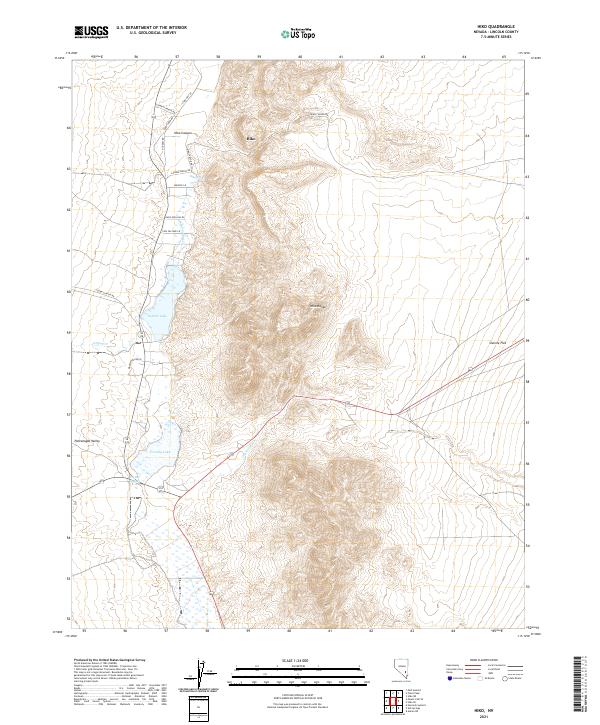
2021 Map of Hiko
USGS Topo · Published 2021About this map
Hiko sits at the northern end of the Pahranagat Valley, a lush corridor defined by a unique desert water system. This modern topographic study details the complex hydrology of the area, where the Hiko Spring and Crystal Springs feed a chain of desert waters including Nesbitt Lake and Frenchy Lake. The settlement pattern follows the valley floor, with family ranching operations indicated by Stewart Ranch Rd and Cannon Ranch Rd. To the east, the terrain rises sharply into the Hiko Range, while the arid expanse of Sixmile Flat stretches toward the horizon. The map captures the intersection of natural springs and human habitation, showing how Pahranagat Cr and Crystal Wash dictate the life of the valley.
Find a feature on this map
27 named features on this map. Tap any name to fly to it.
Don’t see what you’re looking for? This feature index may not catch every label — zoom into the map to look around manually.
Map Details
Editions of this 2021 Hiko Map
This is the sole edition of this map. No revisions or reprints were ever made.
Other maps of this area

1945 · Alamo
USGS Topo · 1:125,000

1954 · Caliente
USGS Topo · 1:250,000

1959 · Caliente
USGS Topo · 1:250,000

1969 · Alamo NE
USGS Topo · 1:24,000

1969 · Ash Springs
USGS Topo · 1:24,000

1970 · Hiko NE
USGS Topo · 1:24,000

1970 · Hiko SE
USGS Topo · 1:24,000

1970 · Fossil Peak
USGS Topo · 1:24,000

1970 · Hiko
USGS Topo · 1:24,000
1983 · Hancock Summit
USGS Topo · 1:24,000