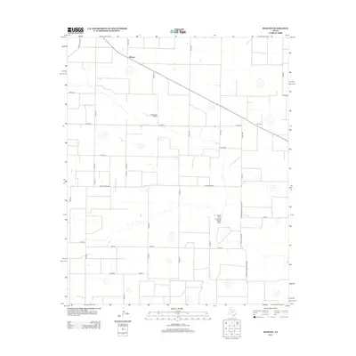
2012 Map of Hilburn
USGS Topo · Published 2012About this map
The settlement of Hilburn sits along the northern edge of this West Texas landscape, defined by a rigid grid of agricultural roads and the seasonal course of the North Fork Running Water Draw. The map reflects a highly organized rural infrastructure, where transportation is managed through a network of county roads and ranch-to-market routes like Ranch Road 168 and Farm-To-Market Road 2284. A notable local landmark is the Hart Aerial Airport, situated centrally among the vast irrigated fields. To the east, the locale of Grisham is positioned along a diagonal rail or road corridor that breaks the otherwise square section lines typical of the High Plains. This 2012 survey illustrates the modern scale of industrial farming in Castro County, where land use is dominated by large-scale operations and the intermittent drainage patterns of the Llano Estacado.
Find a feature on this map
33 named features on this map. Tap any name to fly to it.
Don’t see what you’re looking for? This feature index may not catch every label — zoom into the map to look around manually.
Map Details
Editions of this 2012 Hilburn Map
This is the sole edition of this map. No revisions or reprints were ever made.
Other maps of this area

1954 · Plainview
USGS Topo · 1:250,000

1954 · Clovis
USGS Topo · 1:250,000

1958 · Clovis
USGS Topo · 1:250,000

1958 · Plainview
USGS Topo · 1:250,000

1963 · Hart NW
USGS Topo · 1:24,000

1963 · Olton
USGS Topo · 1:24,000

1963 · Hart SW
USGS Topo · 1:24,000

1965 · Hart
USGS Topo · 1:24,000

1965 · Edmonson
USGS Topo · 1:24,000

1965 · Hilburn
USGS Topo · 1:24,000