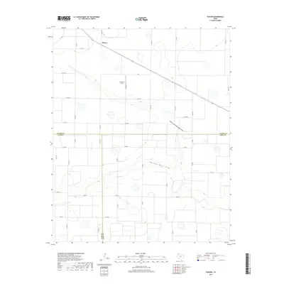
2019 Map of Hilburn
USGS Topo · Published 2019About this map
The small community of Hilburn sits at a geographic crossroads on the Texas High Plains, where the borders of Castro, Lamb, and Hale counties meet. This 2019 survey captures a landscape defined by industrial agriculture and the drainage patterns of the Llano Estacado. The terrain is bifurcated by the North Fork Running Water Draw and the primary Running Water Draw, ephemeral watercourses that carve subtle depressions through the grid of county roads. Local aviation infrastructure is represented by the Hart Aerial Airport, which serves the surrounding farmstead network. The map reveals a highly structured environment where state-maintained routes like FM 168 and FM 2881 connect isolated rural homesteads. This documentation is particularly valuable for researchers tracing land use and property boundaries along the triple-county junction, offering a clear view of the region's modern rural development.
Find a feature on this map
36 named features on this map. Tap any name to fly to it.
Don’t see what you’re looking for? This feature index may not catch every label — zoom into the map to look around manually.
Map Details
Editions of this 2019 Hilburn Map
This is the sole edition of this map. No revisions or reprints were ever made.
Other maps of this area

1954 · Plainview
USGS Topo · 1:250,000

1954 · Clovis
USGS Topo · 1:250,000

1958 · Clovis
USGS Topo · 1:250,000

1958 · Plainview
USGS Topo · 1:250,000

1963 · Hart NW
USGS Topo · 1:24,000

1963 · Olton
USGS Topo · 1:24,000

1963 · Hart SW
USGS Topo · 1:24,000

1965 · Hart
USGS Topo · 1:24,000

1965 · Edmonson
USGS Topo · 1:24,000

1965 · Hilburn
USGS Topo · 1:24,000