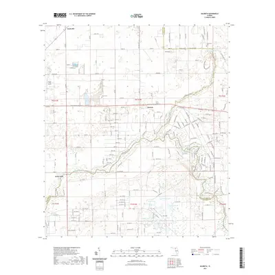
2021 Map of Hildreth
USGS Topo · Published 2021About this map
Ichetucknee Springs State Park dominates the northeastern corner of this Suwannee and Columbia County borderland, centered on the famous crystalline waters of Ichetucknee Springs and the Blue Hole. This hydrologically complex landscape is defined by the confluence of the Ichetucknee River and the Santa Fe River, where the terrain transitions into a series of distinctive wetland features including Sampson Lake, Double Pond, and Grass Pond. Local history and genealogy interests are grounded in the small settlements of Hildreth and Beachville, and the presence of several community burial grounds such as Santa Fe Cem and Hunts Cem. Aviation activity is noted at the Flying C Farm Airport and Fox Field, while the Suwannee River Greenway Trl follows an established corridor through the central rural acreage.
Find a feature on this map
151 named features on this map. Tap any name to fly to it.
Don’t see what you’re looking for? This feature index may not catch every label — zoom into the map to look around manually.
Map Details
Editions of this 2021 Hildreth Map
This is the sole edition of this map. No revisions or reprints were ever made.
Other maps of this area

1954 · Gainesville
USGS Topo · 1:250,000

1954 · Valdosta
USGS Topo · 1:250,000

1958 · Valdosta
USGS Topo · 1:250,000

1958 · Gainesville
USGS Topo · 1:250,000

1959 · Valdosta
USGS Topo · 1:250,000

1959 · Gainesville
USGS Topo · 1:250,000

1963 · Columbia
USGS Topo · 1:24,000

1968 · Branford
USGS Topo · 1:24,000

1968 · Hatchbend
USGS Topo · 1:24,000
1968 · Hildreth
USGS Topo · 1:24,000