Old Maps of Suwannee County, Florida
Explore 123 old maps of Suwannee County, spanning from 1954 to today. These high-resolution historic maps reveal how streets, neighborhoods, landmarks, and natural features evolved over time — perfect for genealogy, metal detecting, research, and local history exploration.
What you can do with these maps:
- See how Suwannee County changed over time: Compare historical maps to modern-day views to trace roads, homesites, rail lines & more.
- View detailed metadata: Each map includes creators, publishers, year, scale, and archive source.
- Overlay maps with satellite & LiDAR: Visualize the past alongside modern tools to explore terrain & human change.
- Trusted historical sources: Maps sourced from the USGS, Library of Congress, and other archives.
- Access maps your way: View online, download high-res files, or order prints for personal or research use.
Start exploring old maps of Suwannee County to uncover forgotten places, hidden landmarks, and the deep history beneath your feet.
Suwannee County, FL maps
(123)- 1954 Map of Day, 1955 Print
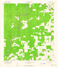
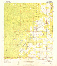 1954 Day1955 Print · USGSLafayette County was a landscape of rail-connected hamlets and expansive cypress bays in the mid-1950s. Researchers can locate family landmarks like the Roger Cem and Dees Cem, or trace the old Southern rail line through Day and Mayo Junction.3 unique versions available
 - 1954 Map of Dowling Park, 1955 Print
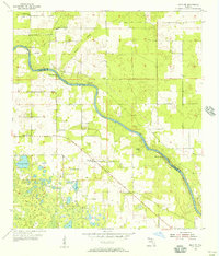
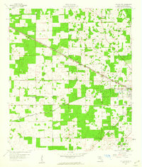
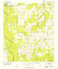 1954 Dowling Park1955 Print · USGSSuwannee County in the mid-fifties is defined by the winding Suwannee River and a quiet network of rural homesteads. Genealogists can trace family connections through the numerous churches and burial grounds, including Mims Cem and Oak Hill Ch.3 unique versions available
 - 1954 Map of Gainesville, 1965 Print
 1954 Gainesville1965 Print · USGSMid-century North Central Florida comes into focus as a landscape of timber, rails, and river towns along the Gulf. Trace family roots in established centers like Gainesville or follow the path of the Suwannee River to the coastal docks of Cedar Key.3 unique versions available
 - 1954 Map of Valdosta, 1967 Print
 1954 Valdosta1967 Print · USGSThe South Georgia and North Florida borderlands are captured here in the mid-fifties, showing the deep timber and wetland networks of the coastal plain. Researchers can trace the path of the Atlantic Coast Line through Valdosta or explore the interior of the Okefenokee Swamp.2 unique versions available
 - 1955 Map of Mayo NE, 1956 Print
 1955 Mayo NE1956 Print · USGSSuwannee County in the mid-1950s reveals a quiet landscape of rural North Florida churches and schools. Local historians can trace family roots through sites like Claywood Cem, Shiloh Sch, and the grounds of Philadelphia Ch.3 unique versions available
 - 1955 Map of Mayo, 1956 Print
 1955 Mayo1956 Print · USGSIn the mid-1950s, the Lafayette County landscape centered on the crossroads of Mayo and the vital waters of the Suwannee River. Researchers can trace family sites at Bethel Cem and Wayfare Cem or locate the old Southern rail line near Peterson.2 unique versions available
 - 1955 Map of Mayo SE, 1956 Print
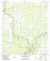
 1955 Mayo SE1956 Print · USGSThe Suwannee River divides Lafayette and Suwannee counties in the mid-1950s, revealing a landscape defined by riverside springs and rural homesteads. Genealogists and local historians can trace family locations near Elliott Cem, Wayside Ch, and the Lady Land Sch.4 unique versions available
 - 1958 Map of Valdosta
 1958 Valdosta1958 Print · USGSSouth Georgia and North Florida are captured here in the mid-fifties, showing the vast Okefenokee Swamp and the vital timber and rail corridors connecting the two states. Researchers can locate the footprint of Moody Air Force Base, trace the Live Oak Perry and Gulf railroad, or find early community sites like Bakers Mill and Paradise Church.
 - 1958 Map of Gainesville
 1958 Gainesville1958 Print · USGSNorth Central Florida’s rail and river networks are frozen in time just before the interstate era. Genealogists and historians can trace the paths of the Atlantic Coast Line through Gainesville or locate coastal settlements like Steinhatchee and Cedar Key.
 - 1958 Map of Fort Union, 1959 Print
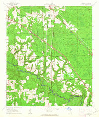
 1958 Fort Union1959 Print · USGSIn the late 1950s, the rural border between Hamilton and Suwannee counties remained defined by the winding Alapaha River and deep-seated community landmarks. Researchers can trace ancestral roots through several country churches like Rosemary Ch and family sites near the Fort Union Cem.3 unique versions available
 - 1958 Map of Madison SE, 1959 Print
 1958 Madison SE1959 Print · USGSMadison and Lafayette counties in the late fifties show a landscape of karst ponds and scattered rural congregations. Genealogists and local historians can locate Midway Ch, the riverfront at the Suwannee River, and landmarks like Tenmile Pond.3 unique versions available
 - 1959 Map of Valdosta
 1959 Valdosta1959 Print · USGSThe Georgia-Florida borderlands in the mid-fifties reveal a landscape of massive blackwater swamps and emerging military aviation hubs. Genealogists and historians can trace rail-stop towns like Fargo and Stockton or explore the interior reaches of the Okefenokee Swamp and Billys Island.
 - 1959 Map of Gainesville
 1959 Gainesville1959 Print · USGSNorth Florida in the mid-fifties is seen here from the Gulf coast to the inland lakes, showing the rail-and-river network before modern highways dominated. Researchers can trace the paths of the Seaboard Air Line through towns like Chiefland and Micanopy, or explore the coastal inlets of Waccasassa Bay.
 - 1959 Map of Ellaville
 1959 Ellaville1959 Print · USGSThe Suwannee and Withlacoochee rivers meet in this mid-century Florida landscape at the borders of Madison and Hamilton counties. Researchers can trace the grounds of the Drew Mansion, locate the Old Columbus Cemetery, and identify rural congregations like St Pauls Church.5 unique versions available
 - 1959 Map of Live Oak West, 1960 Print
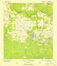
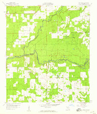
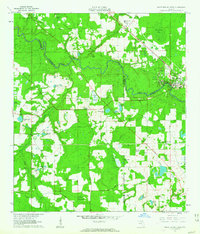
 1959 Live Oak West1960 Print · USGSSuwannee County in the late fifties shows a landscape of rail-connected settlements and rural crossroads. Researchers can trace family sites at Delaware Cem, visit the Agricultural Coliseum, or locate early rail stops at Dickert and Mercer.3 unique versions available
 - 1959 Map of Falmouth, 1960 Print
 1959 Falmouth1960 Print · USGSThe Suwannee River borderlands in the late fifties were a quiet stretch of pine woods and small rural outposts. Researchers can trace the path of the Southern railroad through Newburn or locate local landmarks like Falmouth Spring and the Stroud Cem.3 unique versions available
 - 1961 Map of Live Oak East, 1962 Print
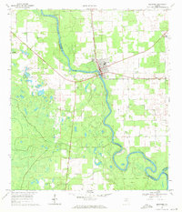
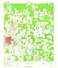 1961 Live Oak East1962 Print · USGSSuwannee County was a major rail and industrial crossroads in the early sixties, centered on the hub of Live Oak. Local historians can trace the intersecting lines of the Southern Railway and find landmarks like the Suwannee Mine and Douglas High Sch.2 unique versions available
 - 1961 Map of Hillcoat, 1963 Print
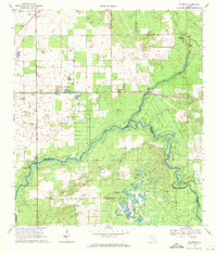
 1961 Hillcoat1963 Print · USGSNorth Florida's river country is captured here in the early sixties, showing the intersection of heavy rail and rural settlement along the river. Genealogists can locate family landmarks like Nunn Cem and Mt Pleasant Ch near the historic Suwannee Springs.2 unique versions available
 - 1961 Map of White Springs West, 1963 Print
 1961 White Springs West1963 Print · USGSThe Suwannee River country in the early sixties was a landscape of river-bend memorials and rural church communities. Genealogists can trace family footprints at Springville Ch or Swift Creek Cem, and locate landmarks like the Sailor Hotel and Bullock Lookout Tower.3 unique versions available
 - 1968 Map of Branford, 1971 Print
 1968 Branford1971 Print · USGSThe Suwannee River country in the late 1960s comes alive in this survey of the river's junction with the Santa Fe. Researchers can trace the rail lines of the Seaboard Coast Line and locate historic sites like Mt Paran Ch and Hunts Cem.3 unique versions available
 - 1968 Map of Hildreth, 1971 Print
 1968 Hildreth1971 Print · USGSThe rural river junction where the Suwannee River meets the Santa Fe River is captured here during the late sixties. Researchers can find long-standing community sites such as Santa Fe Cem Ch and the springhead at Ichetucknee Springs.4 unique versions available
 - 1969 Map of Wellborn, 1971 Print
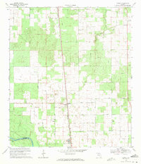
 1969 Wellborn1971 Print · USGSThe Suwannee County countryside comes into focus during the late sixties, centered on the railroad town of Wellborn. Researchers can trace rural lineages through family landmarks like McClellan Cem and isolated country churches such as Mt Beulah Ch.
 - 1969 Map of O'Brien, 1971 Print
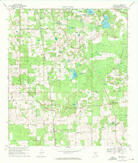
 1969 O'Brien1971 Print · USGSSuwannee County in the late sixties centers on the railroad hamlet of O'Brien and its surrounding network of country churches. Genealogists can trace family landmarks and burial sites like Cedar Grove Cem, Mt Zion Ch, and Pleasant Hill Ch across this river-fed landscape.3 unique versions available
 - 1969 Map of O'Brien SE, 1971 Print
 1969 O'Brien SE1971 Print · USGSSuwannee and Columbia counties are captured during a period of rural agricultural development in the late sixties. Genealogists and local historians can locate community centers like Philadelphia Ch and Evergreen Ch or trace old routes such as Troy Road.3 unique versions available
 - 1969 Map of McAlpin, 1971 Print
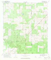
 1969 McAlpin1971 Print · USGSSuwannee County remains a rural agricultural landscape in the late sixties, centered on the rail-fed community of McAlpin. Genealogists and local historians can locate country landmarks like Beulah Hill Ch, Bethlehem Cem, and the Rocky Hill Lookout Tower.3 unique versions available
Showing maps 1-25 of 123
Top cities of Suwannee County
Frequently asked questions
- What are the different types of historical maps available for Suwannee County?
- What is the oldest map of Suwannee County?
- Where can I purchase historical maps of Suwannee County for my home or office?
- Where can I download high-res historical maps of Suwannee County?
- Are there historical topographic maps available for Suwannee County?
- Is there historical aerial imagery available for Suwannee County?
- Where are historical maps of Suwannee County sourced from?