
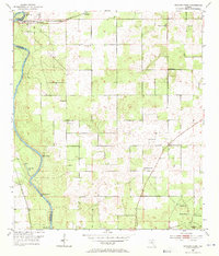
1954 Map of Dowling Park
USGS Topo · Published 1955About this map
The Suwannee River carves a winding path along the western boundary of this North Florida landscape, defining the border between Suwannee and Lafayette counties. This mid-century survey reveals a rural network of small communities and rural institutions, centered on the settlement of Dowling Park and the nearby Orphanage. Numerous springs feed into the river system, including Charles Spring, Thomas Spring, and Blue Spring, suggesting the limestone-rich karst topography of the region.
Find a feature on this map
26 named features on this map. Tap any name to fly to it.
Don’t see what you’re looking for? This feature index may not catch every label — zoom into the map to look around manually.
Map Details
Editions of this 1954 Dowling Park Map
3 editions found
Other maps of this area

1954 · Day SE
USGS Topo · 1:24,000

1954 · Day
USGS Topo · 1:24,000

1954 · Valdosta
USGS Topo · 1:250,000

1955 · Mayo NE
USGS Topo · 1:24,000

1955 · Mayo
USGS Topo · 1:24,000

1955 · Mayo SE
USGS Topo · 1:24,000

1958 · Valdosta
USGS Topo · 1:250,000

1958 · Madison SE
USGS Topo · 1:24,000

1959 · Valdosta
USGS Topo · 1:250,000

1959 · Live Oak West
USGS Topo · 1:24,000