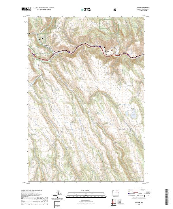
2024 Map of Hilgard
USGS Topo · Published 2024About this map
Grande Ronde River winding through the eastern slopes of the Blue Mountains defines the character of this Union County landscape. The settlements of Hilgard and Perry are established along the river corridor, where the historic route of the Oregon Trail Natl Historic Trl and modern transportation arteries navigate the narrow valley floor. To the north and south, the terrain rises into the Whitman National Forest, dissected by a complex network of drainages including Fivepoints Creek and Whiskey Creek. Higher elevations are marked by landmarks like Mahogany Mtn and the waters of Morgan Lake and Hunter Lake. The map details a transition from river-bottom ranching and transit to the timbered reaches of the national forest, with local history preserved at the Hilgard Cem.
Find a feature on this map
47 named features on this map. Tap any name to fly to it.
Don’t see what you’re looking for? This feature index may not catch every label — zoom into the map to look around manually.
Map Details
Editions of this 2024 Hilgard Map
This is the sole edition of this map. No revisions or reprints were ever made.
Other maps of this area

1953 · Pendleton
USGS Topo · 1:250,000

1956 · Pendleton
USGS Topo · 1:250,000

1963 · La Grande SE
USGS Topo · 1:24,000

1963 · Hilgard
USGS Topo · 1:24,000

1963 · Summerville
USGS Topo · 1:24,000

1964 · Huron
USGS Topo · 1:24,000

1964 · Drumhill Ridge
USGS Topo · 1:24,000

1964 · Kamela SE
USGS Topo · 1:24,000
1965 · Glass Hill
USGS Topo · 1:24,000

1965 · Little Beaver Creek
USGS Topo · 1:24,000