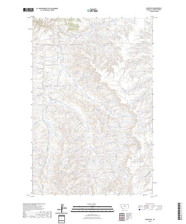
2024 Map of Hilger NW
USGS Topo · Published 2024About this map
Cottonwood Spring serves as a critical water source in this dry Fergus County landscape, where the drainage network of Salt Creek defines the local geography. The territory is deeply dissected by numerous watercourses, including the West Fork Salt Creek, Middle Fork Salt Creek, and East Fork Salt Creek, which converge to shape the complex drainage pattern toward the northern reaches of the quadrangle. In the southeast, the terrain transitions toward Freeze Out Coulee and Box Elder Creek.
Find a feature on this map
18 named features on this map. Tap any name to fly to it.
Don’t see what you’re looking for? This feature index may not catch every label — zoom into the map to look around manually.
Map Details
Editions of this 2024 Hilger NW Map
This is the sole edition of this map. No revisions or reprints were ever made.
Other maps of this area

1954 · Lewistown
USGS Topo · 1:250,000

1959 · Lewistown
USGS Topo · 1:250,000

1964 · Anderson Bridge
USGS Topo · 1:24,000

1978 · Seventytwo Hills
USGS Topo · 1:24,000

1978 · Wild Bill Flat East
USGS Topo · 1:24,000

1978 · Lewistown
USGS Topo · 1:100,000
1985 · Hilger NW
USGS Topo · 1:24,000
1985 · Kendall
USGS Topo · 1:24,000

1985 · Hilger
USGS Topo · 1:24,000
1985 · Christina
USGS Topo · 1:24,000