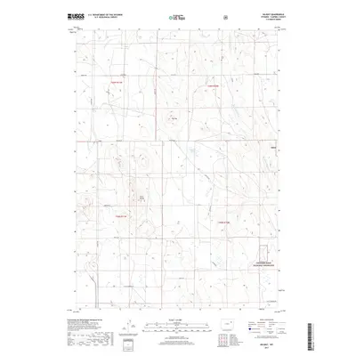
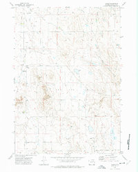
2017 Map of Hilight
USGS Topo · Published 2017About this map
The settlement of Hilight sits within a landscape defined by ranching roads and intermittent waterways in Campbell County. This 2017 survey shows a network of local routes such as Keeline Rd and Hilight Rd that provide access across the high plains. A significant portion of the area is managed as part of the Thunder Basin National Grassland, also labeled as Tbng, illustrating the region's dedication to conservation and public grazing.
Find a feature on this map
25 named features on this map. Tap any name to fly to it.
Don’t see what you’re looking for? This feature index may not catch every label — zoom into the map to look around manually.
Map Details
Editions of this 2017 Hilight Map
This is the sole edition of this map. No revisions or reprints were ever made.
Other maps of this area

1955 · Newcastle
USGS Topo · 1:250,000

1958 · Newcastle
USGS Topo · 1:250,000
1971 · Open A Ranch
USGS Topo · 1:24,000
1971 · Rough Creek
USGS Topo · 1:24,000
1971 · Reno Junction
USGS Topo · 1:24,000
1971 · Reno Reservoir
USGS Topo · 1:24,000
1971 · Piney Canyon NW
USGS Topo · 1:24,000
1971 · Little Thunder Reservoir
USGS Topo · 1:24,000
1971 · Eagle Rock
USGS Topo · 1:24,000
1971 · Hilight
USGS Topo · 1:24,000