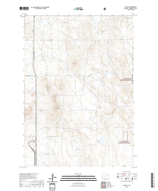
2021 Map of Hilight
USGS Topo · Published 2021About this map
Thunder Basin National Grassland dominates the eastern landscape of this Campbell County quadrangle, where the high plains are carved by a network of drainage systems. The hydrologic character of the region is defined by the headwaters of several ephemeral streams, including the Middle Fork Coal Creek and Black Thunder Creek, which weave through the arid terrain. Notable topographic landmarks such as Two Top and Four Points rise above the surrounding sections, serving as distinct navigational markers in this open country.
Find a feature on this map
23 named features on this map. Tap any name to fly to it.
Don’t see what you’re looking for? This feature index may not catch every label — zoom into the map to look around manually.
Map Details
Editions of this 2021 Hilight Map
This is the sole edition of this map. No revisions or reprints were ever made.
Other maps of this area

1955 · Newcastle
USGS Topo · 1:250,000

1958 · Newcastle
USGS Topo · 1:250,000

1971 · Open A Ranch
USGS Topo · 1:24,000

1971 · Rough Creek
USGS Topo · 1:24,000

1971 · Reno Junction
USGS Topo · 1:24,000

1971 · Reno Reservoir
USGS Topo · 1:24,000

1971 · Piney Canyon NW
USGS Topo · 1:24,000

1971 · Little Thunder Reservoir
USGS Topo · 1:24,000
1971 · Eagle Rock
USGS Topo · 1:24,000
1971 · Hilight
USGS Topo · 1:24,000