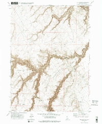
1972 Map of Hill Pasture
USGS Topo · Published 1975About this map
Big Jacks Creek carves a deep, winding path through the high plateau country of Owyhee County, defining the drainage patterns of this remote Idaho landscape in the early 1970s. The map reveals a land utilized for seasonal grazing and water management, evidenced by the presence of cattle-rearing infrastructure like the Harveys V Reservoir and the Dry Canyon Reservoir. Named landmarks such as Willies Point and Hill Pasture Point rise above the drainage of Willies Canyon, while localized human activity is anchored at the Harvey Place and Holman Cabin. The network of Jeep Trails and a prominent Pipeline cutting across the northern reaches highlight the industrial and recreational access points into this high-desert terrain during the post-war era.
Find a feature on this map
20 named features on this map. Tap any name to fly to it.
Don’t see what you’re looking for? This feature index may not catch every label — zoom into the map to look around manually.
Map Details
Editions of this 1972 Hill Pasture Map
2 editions found
Other maps of this area

1955 · Jordan Valley
USGS Topo · 1:250,000

1955 · Twin Falls
USGS Topo · 1:250,000

1956 · Big Hill
USGS Topo · 1:62,500

1957 · Jordan Valley
USGS Topo · 1:250,000

1958 · Twin Falls
USGS Topo · 1:250,000

1958 · Jordan Valley
USGS Topo · 1:250,000
1972 · Hill Pasture
USGS Topo · 1:24,000

1972 · Wickahoney Point
USGS Topo · 1:24,000

1972 · Turner Table
USGS Topo · 1:24,000
1972 · Big Horse Basin Gap
USGS Topo · 1:24,000