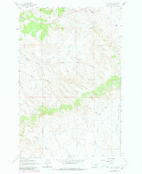
1963 Map of Hill Ranch
USGS Topo · Published 1980About this map
The Hill Ranch homestead anchors this interior portion of Garfield County, marking a landscape defined by an intricate network of drainages and seasonal watercourses. Surveyed in the early 1960s with updates from 1978, the map illustrates the rugged cattle-country geography of central Montana before modern consolidation. Notable water features like Sage Creek, Dog Creek, and Hen Creek carve through the northern terrain, while the southern reaches are dominated by steep-walled coulees, including Hughes Coulee and Youderian Coulee. This specific era of mapping captures the sparse ranching infrastructure and isolated landmarks such as Dutch Oven and Melnick Coulee that served as critical navigational points for local residents. The map also records early industrial activity through various scattered Gravel Pit locations and a Drill Hole, reflecting the region's intersection of traditional ranching and exploratory resource extraction during the mid-to-late 20th century.
Find a feature on this map
15 named features on this map. Tap any name to fly to it.
Don’t see what you’re looking for? This feature index may not catch every label — zoom into the map to look around manually.
Map Details
Editions of this 1963 Hill Ranch Map
2 editions found
Other maps of this area

1954 · Jordan
USGS Topo · 1:250,000

1954 · Forsyth
USGS Topo · 1:250,000

1956 · Jordan
USGS Topo · 1:250,000

1957 · Forsyth
USGS Topo · 1:250,000

1958 · Jordan
USGS Topo · 1:250,000

1958 · Forsyth
USGS Topo · 1:250,000

1962 · Mosby
USGS Topo · 1:24,000

1962 · Maxwell Ranch
USGS Topo · 1:24,000

1962 · Kincheloe Ranch
USGS Topo · 1:24,000

1962 · Mosby SE
USGS Topo · 1:24,000