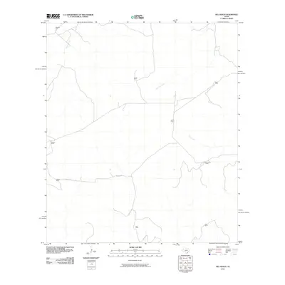
2010 Map of Hill Ranch
USGS Topo · Published 2010About this map
Hill Ranch and other family-named homesteads characterize this portion of Kimble County, Texas, reflecting the enduring ranching tradition of the Edwards Plateau. The landscape is defined by its drainage basins, including the headwaters of Maynard Creek in the northwest and Bois d'Arc Creek flowing through the center. Small private water tanks and modest road networks, such as Nethery Rd, connect widely dispersed ranch houses like Felthouse Ranch and Gerhart Ranch. This 2010 topographic representation shows the area before significant modern fragmentation, where large holdings like Rose Ranch and Cardwell Ranch still shaped the local geography. Significant for genealogists tracing West Texas family history, the map identifies specific properties like Ridenhower Ranch and Nethery Ranch that have often remained in family hands for generations.
Find a feature on this map
13 named features on this map. Tap any name to fly to it.
Don’t see what you’re looking for? This feature index may not catch every label — zoom into the map to look around manually.
Map Details
Editions of this 2010 Hill Ranch Map
This is the sole edition of this map. No revisions or reprints were ever made.
Other maps of this area

1893 · Rock Springs
USGS Topo · 1:125,000

1926 · Segovia 2-c
USGS Topo · 1:48,000

1932 · Junction
USGS Topo · 1:62,500

1954 · Llano
USGS Topo · 1:250,000

1954 · Sonora
USGS Topo · 1:250,000

1955 · Llano
USGS Topo · 1:250,000

1956 · Llano
USGS Topo · 1:250,000

1958 · Sonora
USGS Topo · 1:250,000

1962 · Hill Ranch
USGS Topo · 1:24,000

1962 · Roosevelt
USGS Topo · 1:24,000