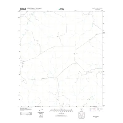
2012 Map of Hill Ranch
USGS Topo · Published 2012About this map
Hill Ranch and surrounding large livestock holdings characterize this portion of Kimble County, where an established network of private and county roads connects remote family-named operations. The landscape is defined by the drainage of several seasonal waterways, including Salina Cr and Bois d'Arc Cr, which cut through the limestone terrain typical of the Edwards Plateau. The presence of the J R Ranch Airport near Ridenhower Ranch underscores the logistical reliance on private aviation for managing these expansive Texas ranchlands. From the northern bounds at Felthouse Ranch to the southern reach near Shay Ranch, the map reveals a sparsely populated area where cattle and sheep ranching remain the primary land use. Local transit follows routes like Co Rd-122 and Nethery Rd, which link the various homesteads including Gerhart Ranch and Jetton Ranch to the wider region.
Find a feature on this map
21 named features on this map. Tap any name to fly to it.
Don’t see what you’re looking for? This feature index may not catch every label — zoom into the map to look around manually.
Map Details
Editions of this 2012 Hill Ranch Map
This is the sole edition of this map. No revisions or reprints were ever made.
Other maps of this area

1893 · Rock Springs
USGS Topo · 1:125,000

1926 · Segovia 2-c
USGS Topo · 1:48,000

1932 · Junction
USGS Topo · 1:62,500

1954 · Llano
USGS Topo · 1:250,000

1954 · Sonora
USGS Topo · 1:250,000

1955 · Llano
USGS Topo · 1:250,000

1956 · Llano
USGS Topo · 1:250,000

1958 · Sonora
USGS Topo · 1:250,000

1962 · Hill Ranch
USGS Topo · 1:24,000

1962 · Roosevelt
USGS Topo · 1:24,000