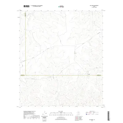
2019 Map of Hill Ranch
USGS Topo · Published 2019About this map
The intersection of Kimble, Sutton, and Edwards Counties defines this landscape in the Edwards Plateau region. A network of rural routes, including Nethery Rd and Co Rd 120, navigates the complex system of limestone draws and creek beds that characterize this part of West Texas. Hill Ranch and the J R Ranch Airport serve as central landmarks in a region largely dedicated to large-scale ranching and private landholdings. Waterways like Maynard Cr, Bois d'Arc Cr, and Salina Cr carve through the topography, though they often flow only during significant rainfall. The presence of Knust Draw and the various county roads illustrates the challenges of transportation and land management in a territory where the boundaries of three counties converge.
Find a feature on this map
17 named features on this map. Tap any name to fly to it.
Don’t see what you’re looking for? This feature index may not catch every label — zoom into the map to look around manually.
Map Details
Editions of this 2019 Hill Ranch Map
This is the sole edition of this map. No revisions or reprints were ever made.
Other maps of this area

1893 · Rock Springs
USGS Topo · 1:125,000

1926 · Segovia 2-c
USGS Topo · 1:48,000

1932 · Junction
USGS Topo · 1:62,500

1954 · Llano
USGS Topo · 1:250,000

1954 · Sonora
USGS Topo · 1:250,000

1955 · Llano
USGS Topo · 1:250,000

1956 · Llano
USGS Topo · 1:250,000

1958 · Sonora
USGS Topo · 1:250,000

1962 · Hill Ranch
USGS Topo · 1:24,000

1962 · Roosevelt
USGS Topo · 1:24,000