
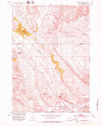
1951 Map of Hillberry Rim
USGS Topo · Published 1953About this map
Hillberry Rim dominates the central landscape of this 1951 survey, carving a distinct geological boundary through the high plains of the Missouri River Basin development area. The terrain is defined by dramatic erosional features with evocative local names such as Hole in the Ground and Wild Horse Heaven. This region, straddling the border of Park and Hot Springs counties, reflects a specialized ranching economy centered on livestock management and water control.
Find a feature on this map
18 named features on this map. Tap any name to fly to it.
Don’t see what you’re looking for? This feature index may not catch every label — zoom into the map to look around manually.
Map Details
Editions of this 1951 Hillberry Rim Map
2 editions found
Other maps of this area

1911 · Meeteetse
USGS Topo · 1:62,500

1913 · Meeteetse
USGS Topo · 1:62,500

1913 · Grass Creek Basin
USGS Topo · 1:62,500

1915 · Grass Creek Basin
USGS Topo · 1:62,500

1951 · Gillies Draw
USGS Topo · 1:24,000

1951 · Wilson Spring
USGS Topo · 1:24,000

1951 · Dead Indian Hill
USGS Topo · 1:24,000

1955 · Cody
USGS Topo · 1:250,000

1955 · Thermopolis
USGS Topo · 1:250,000

1956 · Adam Weiss Peak
USGS Topo · 1:24,000