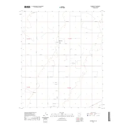
2023 Map of Hillburn City
USGS Topo · Published 2023About this map
Hillburn City serves as the central point of this Lea County landscape, illustrating the rectilinear land division common in the High Plains of eastern New Mexico. The area is defined by a dense grid of rural roads and section lines, with family-named routes such as Willyard Ln, Osborn Ln, and Zimmerman Ln providing access to individual homesteads and ranching parcels. For genealogists and local historians, the map identifies significant burial sites including the Old Plainview Cem and Cox Cem, which anchor the history of early families in the region. The southern portion of the quadrangle shows the small residential clustering of Quail Acres, while the descriptive name Six Shooter alludes to the frontier character that persists in the local nomenclature. This 2023 survey provides a clear view of how modern rural life remains structured by the historical Public Land Survey System.
Find a feature on this map
41 named features on this map. Tap any name to fly to it.
Don’t see what you’re looking for? This feature index may not catch every label — zoom into the map to look around manually.
Map Details
Editions of this 2023 Hillburn City Map
This is the sole edition of this map. No revisions or reprints were ever made.
Other maps of this area

1954 · Hobbs
USGS Topo · 1:250,000

1954 · Brownfield
USGS Topo · 1:250,000

1958 · Brownfield
USGS Topo · 1:250,000

1958 · Hobbs
USGS Topo · 1:250,000

1962 · Brownfield
USGS Topo · 1:250,000

1962 · Lovington
USGS Topo · 1:24,000

1962 · Lovington
USGS Topo · 1:62,500

1970 · Prairieview
USGS Topo · 1:24,000

1970 · Prairieview NW
USGS Topo · 1:24,000

1970 · Hillburn City
USGS Topo · 1:24,000