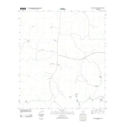
2012 Map of Hillcrest Ranch
USGS Topo · Published 2012About this map
Hillcrest Ranch and its neighboring family holdings define this portion of Kerr County, where the headwaters of the Frio River system carve deep drainage patterns through the landscape. This 2012 survey documents a rural environment dominated by large pastoral estates like the Chittim Ranch and Wilson Ranch. The geography is intricately mapped through its various waterways and topographic depressions, including the W Frio River, E Frio River, and numerous named draws such as Big Draw and Armadillo Draw. These seasonal drainage paths were vital for early ranching operations, supported by landmarks like the Old Windmill and the Martin Camp Spring. The presence of Auld Ranch and Haby Ranch alongside secondary roads like Pasture Rd and Bowman reveals a network of land management and movement that has persisted through generations of Texas hill country heritage.
Find a feature on this map
28 named features on this map. Tap any name to fly to it.
Don’t see what you’re looking for? This feature index may not catch every label — zoom into the map to look around manually.
Map Details
Editions of this 2012 Hillcrest Ranch Map
This is the sole edition of this map. No revisions or reprints were ever made.
Other maps of this area

1954 · Llano
USGS Topo · 1:250,000

1954 · San Antonio
USGS Topo · 1:250,000

1955 · Llano
USGS Topo · 1:250,000

1956 · Llano
USGS Topo · 1:250,000

1957 · San Antonio
USGS Topo · 1:250,000

1963 · Garven Store
USGS Topo · 1:24,000

1964 · Hillcrest Ranch
USGS Topo · 1:24,000

1964 · Circle Bluff
USGS Topo · 1:24,000

1964 · Boneyard Draw
USGS Topo · 1:24,000

1964 · Sabinal Canyon
USGS Topo · 1:24,000