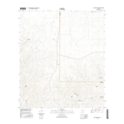
2016 Map of Hillcrest Ranch
USGS Topo · Published 2016About this map
The Hillcrest Ranch property anchors this portion of the Texas Hill Country, where the landscape is defined by the headwaters of the Frio River system. This 2016 survey shows the convergence of the W Frio River and E Frio River amidst a complex network of seasonal drainages known locally as draws. The terrain is marked by significant topographical relief, featuring landmarks like Yellow Bluff Draw and Big Draw that illustrate the erosional patterns of the Edwards Plateau. Local water sources, vital for ranching in this arid environment, are recorded at sites such as Martin Camp Spring. The map documents the rural infrastructure of the early 21st century, including Pasture Rd and Haby Ranch Rd, which navigate the deeply incised valleys and ridges near the border of Real and Kerr Counties.
Find a feature on this map
23 named features on this map. Tap any name to fly to it.
Don’t see what you’re looking for? This feature index may not catch every label — zoom into the map to look around manually.
Map Details
Editions of this 2016 Hillcrest Ranch Map
This is the sole edition of this map. No revisions or reprints were ever made.
Other maps of this area

1954 · Llano
USGS Topo · 1:250,000

1954 · San Antonio
USGS Topo · 1:250,000

1955 · Llano
USGS Topo · 1:250,000

1956 · Llano
USGS Topo · 1:250,000

1957 · San Antonio
USGS Topo · 1:250,000

1963 · Garven Store
USGS Topo · 1:24,000

1964 · Hillcrest Ranch
USGS Topo · 1:24,000

1964 · Circle Bluff
USGS Topo · 1:24,000

1964 · Boneyard Draw
USGS Topo · 1:24,000

1964 · Sabinal Canyon
USGS Topo · 1:24,000