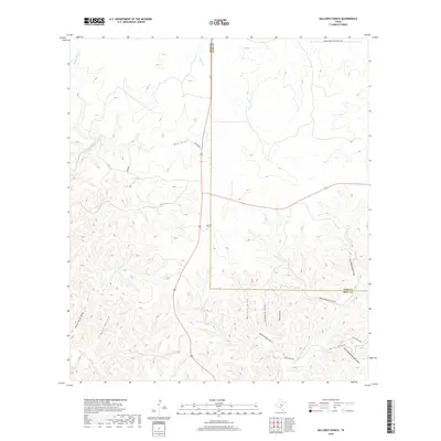
2019 Map of Hillcrest Ranch
USGS Topo · Published 2019About this map
Hillcrest Ranch sits at the heart of this Edwards Plateau landscape, where the headwaters of the Frio River system carve through the limestone terrain of the Texas Hill Country. The map documents a complex network of seasonal drainages, including Yellow Bluff Draw, Bushwack Draw, and Armadillo Draw, which feed into the W Frio River and E Frio River. This 2019 survey shows the persistent importance of ranching heritage through naming conventions like Bobby Shelton Ranch Rd NW and Haby Ranch Rd.
Find a feature on this map
24 named features on this map. Tap any name to fly to it.
Don’t see what you’re looking for? This feature index may not catch every label — zoom into the map to look around manually.
Map Details
Editions of this 2019 Hillcrest Ranch Map
This is the sole edition of this map. No revisions or reprints were ever made.
Other maps of this area

1954 · Llano
USGS Topo · 1:250,000

1954 · San Antonio
USGS Topo · 1:250,000

1955 · Llano
USGS Topo · 1:250,000

1956 · Llano
USGS Topo · 1:250,000

1957 · San Antonio
USGS Topo · 1:250,000

1963 · Garven Store
USGS Topo · 1:24,000

1964 · Hillcrest Ranch
USGS Topo · 1:24,000

1964 · Circle Bluff
USGS Topo · 1:24,000

1964 · Boneyard Draw
USGS Topo · 1:24,000

1964 · Sabinal Canyon
USGS Topo · 1:24,000