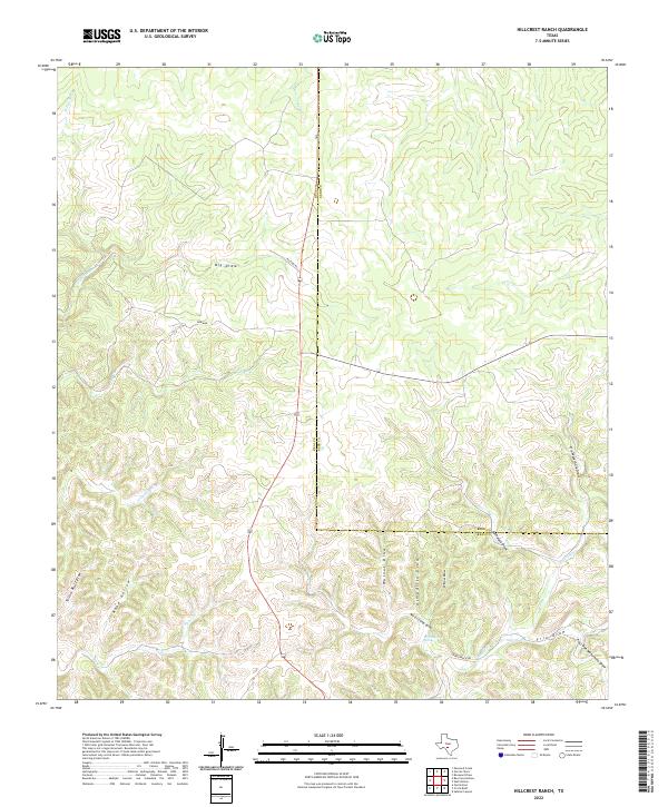
2022 Map of Hillcrest Ranch
USGS Topo · Published 2022About this map
The divide between Real and Kerr counties defines this modern landscape on the Edwards Plateau. The terrain is deeply incised by a network of seasonal watercourses and draws that feed the headwaters of the Frio River system. Key water sources like Martin Camp Spring and the W Frio River have historically dictated the placement of ranch infrastructure, connected by local routes such as Pasture Rd and Haby Ranch Rd. This 2022 survey illustrates the contemporary ranching footprint, where local family names and landmarks like Martin Camp Draw and Yellow Bluff Draw persist. The drainage patterns, including Big Draw and Grapevine Cr, show the topographical complexity of a region where water management and large-scale landholdings remain the primary drivers of human geography.
Find a feature on this map
23 named features on this map. Tap any name to fly to it.
Don’t see what you’re looking for? This feature index may not catch every label — zoom into the map to look around manually.
Map Details
Editions of this 2022 Hillcrest Ranch Map
This is the sole edition of this map. No revisions or reprints were ever made.
Other maps of this area

1954 · Llano
USGS Topo · 1:250,000

1954 · San Antonio
USGS Topo · 1:250,000

1955 · Llano
USGS Topo · 1:250,000

1956 · Llano
USGS Topo · 1:250,000

1957 · San Antonio
USGS Topo · 1:250,000

1963 · Garven Store
USGS Topo · 1:24,000

1964 · Hillcrest Ranch
USGS Topo · 1:24,000

1964 · Circle Bluff
USGS Topo · 1:24,000

1964 · Boneyard Draw
USGS Topo · 1:24,000

1964 · Sabinal Canyon
USGS Topo · 1:24,000