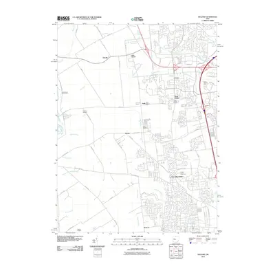
2010 Map of Hilliard
USGS Topo · Published 2010About this map
Hilliard and its surrounding townships show a suburban landscape in transition during this 2010 survey, where historical agricultural roots meet modern development. The central municipal core is anchored by the Franklin County Fairgrounds and the Hilliard Post Office, while the northern and western sections of the map preserve several small historic settlements such as Kileville, Amlin, and Lamb Corners. The area’s agrarian past is visible in the dense network of drainage canals, including the Clover Groff Ditch and South Fork Indian Run, which crisscross the territory.
Find a feature on this map
76 named features on this map. Tap any name to fly to it.
Don’t see what you’re looking for? This feature index may not catch every label — zoom into the map to look around manually.
Map Details
Editions of this 2010 Hilliard Map
This is the sole edition of this map. No revisions or reprints were ever made.
Other maps of this area

1901 · Dublin
USGS Topo · 1:62,500

1903 · Dublin
USGS Topo · 1:62,500

1907 · London
USGS Topo · 1:62,500

1916 · Milford Center
USGS Topo · 1:62,500

1923 · West Columbus
USGS Topo · 1:62,500

1925 · West Columbus
USGS Topo · 1:62,500

1944 · Milford Center
USGS Topo · 1:62,500

1947 · Columbus
USGS Topo · 1:250,000

1950 · Marion
USGS Topo · 1:250,000
1954 · Shawnee Hills
USGS Topo · 1:24,000