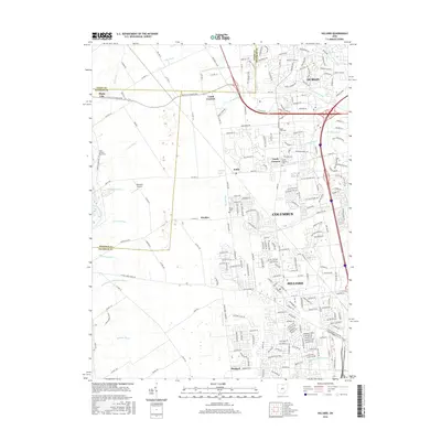
2016 Map of Hilliard
USGS Topo · Published 2016About this map
The suburban expansion of Columbus into the northwestern corner of Franklin County is documented here during the mid-2010s. This landscape is a hybrid of deep-rooted rural infrastructure and rapid modern residential growth, where agricultural drainages like Cary Ditch and Ballenger Ditch meet the burgeoning street networks of Hilliard and Dublin. While large developments dominate the eastern half, the western margins near Plain City and along Big Darby Creek retain a more open character, punctuated by historic waypoints like Lamb Corners and Hayden. Genealogists will find interest in the preserved local cemeteries, including Smith-Calhoun Road Cem and Saint John Cem, which stand as quiet anchors amidst the transforming terrain. The map also captures the distinct boundary between Madison and Franklin Counties, showing how township roads and industrial parkways have begun to overwrite the earlier agrarian grid.
Find a feature on this map
220 named features on this map. Tap any name to fly to it.
Don’t see what you’re looking for? This feature index may not catch every label — zoom into the map to look around manually.
Map Details
Editions of this 2016 Hilliard Map
This is the sole edition of this map. No revisions or reprints were ever made.
Other maps of this area

1901 · Dublin
USGS Topo · 1:62,500

1903 · Dublin
USGS Topo · 1:62,500

1907 · London
USGS Topo · 1:62,500

1916 · Milford Center
USGS Topo · 1:62,500

1923 · West Columbus
USGS Topo · 1:62,500

1925 · West Columbus
USGS Topo · 1:62,500

1944 · Milford Center
USGS Topo · 1:62,500

1947 · Columbus
USGS Topo · 1:250,000

1950 · Marion
USGS Topo · 1:250,000
1954 · Shawnee Hills
USGS Topo · 1:24,000