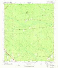
1970 Map of Hilliard NE
USGS Topo · Published 1973About this map
The Little St Marys River meanders through this portion of Nassau County, defining a landscape dominated by extensive wetland systems and sparse upland settlements in the early 1970s. The map reveals the intricate water network of Cabbage Creek Swamp and White Oak Swamp, where numerous firebreaks and jeep trails crisscross the terrain, suggesting the importance of forestry and land management during this period. Small communities and landmarks serve as focal points for local history and genealogy, including Evergreen in the east and the settlement of Lessie near the river. Inland from the riverbanks, rural life centers around Ephesus Ch and Mt Horne Ch, while the Braddock Cem stands as a quiet record of early area families. In the southern reach, the Seaboard Coast Line railroad cuts through the terrain near Mills Creek, illustrating the transportation infrastructure that linked these rural Florida outposts to the wider region.
Find a feature on this map
23 named features on this map. Tap any name to fly to it.
Don’t see what you’re looking for? This feature index may not catch every label — zoom into the map to look around manually.
Map Details
Editions of this 1970 Hilliard NE Map
3 editions found
Other maps of this area

1917 · Boulogne
USGS Topo · 1:62,500

1917 · Hilliard
USGS Topo · 1:62,500

1918 · St Marys
USGS Topo · 1:62,500

1918 · Kingsland
USGS Topo · 1:62,500

1919 · St Marys
USGS Topo · 1:62,500

1919 · Hilliard
USGS Topo · 1:62,500

1919 · Boulogne
USGS Topo · 1:62,500

1948 · Jacksonville
USGS Topo · 1:250,000

1957 · Jacksonville
USGS Topo · 1:250,000

1958 · Gross
USGS Topo · 1:24,000