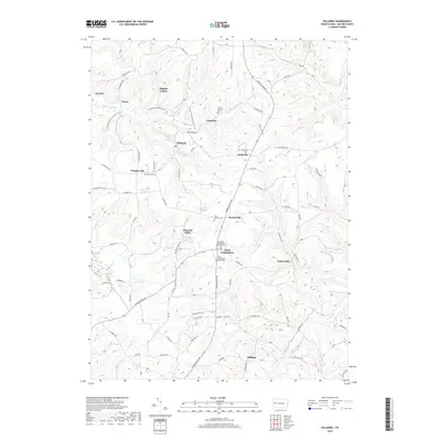
2019 Map of Hilliards
USGS Topo · Published 2019About this map
The waters of Slippery Rock Cr and Bear Cr carve through this section of Butler County, defining a landscape marked by small settlements and a deep-seated Methodist heritage. In the south, the village of North Washington serves as a local anchor, flanked by the Old North Washington Methodist Cem and the North Washington Union Cem. These burial grounds, along with others like Mount Varnum Cem and Rosewood Cem near Whiskerville, provide significant data points for genealogists tracing the lineage of families in the surrounding hills.
Find a feature on this map
104 named features on this map. Tap any name to fly to it.
Don’t see what you’re looking for? This feature index may not catch every label — zoom into the map to look around manually.
Map Details
Editions of this 2019 Hilliards Map
This is the sole edition of this map. No revisions or reprints were ever made.
Other maps of this area

1900 · Kittanning
USGS Topo · 1:62,500

1902 · Kittanning
USGS Topo · 1:62,500

1907 · Foxburg
USGS Topo · 1:62,500

1908 · Foxburg
USGS Topo · 1:62,500

1909 · Butler
USGS Topo · 1:62,500

1910 · Hilliards
USGS Topo · 1:62,500

1911 · Butler
USGS Topo · 1:62,500

1912 · Hilliards
USGS Topo · 1:62,500

1944 · Hilliards
USGS Topo · 1:62,500

1953 · Pittsburgh
USGS Topo · 1:250,000