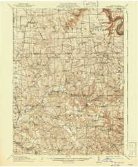
1912 Map of Hilliards
USGS Topo · Published 1941About this map
Clintonville and Eau Claire serve as central hubs in this early 20th-century landscape, which reveals a dense network of rural infrastructure across Butler and Venango Counties. The map illustrates a period when small-scale milling and local post offices were vital to the community, marked by features such as Fillmans Mill, Sutton Mill, and the Mechanicsville Wesley PO. Industrial activity is evident in the rail corridors of the Bessemer and Lake Erie RR, which connects settlements like Hilliards, Argentine, and Boyer's Annandale Sta. The terrain is deeply etched by Slippery Rock Creek and its many tributaries, while family-named landmarks like the Anderson Stone House and Vanderlin House provide specific points of interest for genealogists tracing local heritage. Numerous country schools, including Victory School and Coal Valley School, underscore the established nature of these townships during the pre-war era.
Find a feature on this map
129 named features on this map. Tap any name to fly to it.
Don’t see what you’re looking for? This feature index may not catch every label — zoom into the map to look around manually.
Map Details
Editions of this 1912 Hilliards Map
4 editions found

Other maps of this area

1900 · Kittanning
USGS Topo · 1:62,500

1902 · Kittanning
USGS Topo · 1:62,500

1907 · Foxburg
USGS Topo · 1:62,500

1908 · Foxburg
USGS Topo · 1:62,500

1908 · Zelienople
USGS Topo · 1:62,500

1909 · Franklin
USGS Topo · 1:62,500

1909 · Butler
USGS Topo · 1:62,500

1910 · Zelienople
USGS Topo · 1:62,500

1910 · Hilliards
USGS Topo · 1:62,500

1911 · Franklin
USGS Topo · 1:62,500