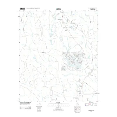
2013 Map of Hillister
USGS Topo · Published 2013About this map
Hillister and the surrounding piney woods of Tyler County are defined by a complex network of creeks and small impoundments. The landscape is dominated by the drainages of Big Cypress Cr and Little Cypress Cr, which feed numerous named water bodies like Boykin Lake Number 1 and the expansive Lake Charmaine. This 2013 survey illustrates a region where local geography is tied to timber and water, with residential developments like those around the Timber Lakes and Sawyers Lakes showing the late 20th-century growth patterns of East Texas.
Find a feature on this map
128 named features on this map. Tap any name to fly to it.
Don’t see what you’re looking for? This feature index may not catch every label — zoom into the map to look around manually.
Map Details
Editions of this 2013 Hillister Map
This is the sole edition of this map. No revisions or reprints were ever made.
Other maps of this area

1954 · Beaumont
USGS Topo · 1:250,000

1955 · Woodville
USGS Topo · 1:62,500

1955 · Camden
USGS Topo · 1:62,500

1957 · Beaumont
USGS Topo · 1:250,000

1958 · Segno
USGS Topo · 1:62,500

1958 · Warren
USGS Topo · 1:62,500

1984 · Beaumont
USGS Topo · 1:250,000

1984 · Jacks Creek South
USGS Topo · 1:24,000

1984 · Jacks Creek North
USGS Topo · 1:24,000
1984 · Woodville
USGS Topo · 1:24,000