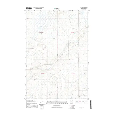
2016 Map of Hillman
USGS Topo · Published 2016About this map
Skunk River and its meandering tributaries, including Hillman Cr and Little Mink Cr, define the drainage patterns of this central Minnesota landscape in Morrison County. The village of Hillman sits in the southeastern corner of the quadrangle, serving as a focal point for a community largely shaped by the Public Land Survey System’s rigid grid of section roads like Co Rd 8 and Co Rd 47. This network of local routes, including Ranch Rd and Riverside Rd, connects the scattered farmsteads and agricultural plots that dominate the terrain between wetland pockets.
Find a feature on this map
41 named features on this map. Tap any name to fly to it.
Don’t see what you’re looking for? This feature index may not catch every label — zoom into the map to look around manually.
Map Details
Editions of this 2016 Hillman Map
This is the sole edition of this map. No revisions or reprints were ever made.
Other maps of this area

1948 · Pierz
USGS Topo · 1:62,500

1948 · Lastrup
USGS Topo · 1:62,500

1950 · Lastrup
USGS Topo · 1:62,500

1950 · Pierz
USGS Topo · 1:62,500

1953 · Duluth
USGS Topo · 1:250,000

1953 · Brainerd
USGS Topo · 1:250,000

1953 · Saint Cloud
USGS Topo · 1:250,000

1953 · Stillwater
USGS Topo · 1:250,000

1955 · Stillwater
USGS Topo · 1:250,000

1957 · Brainerd
USGS Topo · 1:250,000