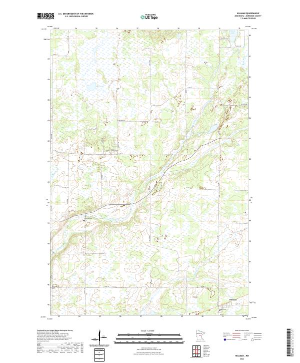
2022 Map of Hillman
USGS Topo · Published 2022About this map
The town of Hillman anchors the southeastern corner of this modern survey, where the township roads of Morrison County meet the winding course of the Skunk River. This landscape is defined by its extensive wetland networks and glacial depressions, characteristic of central Minnesota. The river meanders across the center of the quadrangle, joined by tributaries like Little Mink Cr and Hillman Cr. For local historians and genealogists, the map identifies key community landmarks including Saint Rita Cem near the town center and the more secluded Pine Tree Cem located further north. The northern reaches of the quadrangle feature several water bodies, most notably Peavy Lake and Mud Lake, which are surrounded by the grid-patterned rural routes like 233rd St and Riverside Rd that provide access to this largely pastoral and swampy terrain.
Find a feature on this map
37 named features on this map. Tap any name to fly to it.
Don’t see what you’re looking for? This feature index may not catch every label — zoom into the map to look around manually.
Map Details
Editions of this 2022 Hillman Map
This is the sole edition of this map. No revisions or reprints were ever made.
Other maps of this area

1948 · Pierz
USGS Topo · 1:62,500

1948 · Lastrup
USGS Topo · 1:62,500

1950 · Lastrup
USGS Topo · 1:62,500

1950 · Pierz
USGS Topo · 1:62,500

1953 · Duluth
USGS Topo · 1:250,000

1953 · Brainerd
USGS Topo · 1:250,000

1953 · Saint Cloud
USGS Topo · 1:250,000

1953 · Stillwater
USGS Topo · 1:250,000

1955 · Stillwater
USGS Topo · 1:250,000

1957 · Brainerd
USGS Topo · 1:250,000