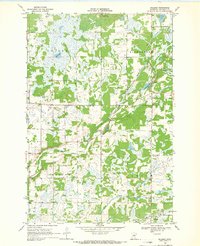
1968 Map of Hillman
USGS Topo · Published 1970About this map
Hillman serves as the central hub of this late-1960s landscape, where the Soo railroad line cuts through the southern reaches of Morrison County. The topography is defined by the winding course of the Skunk River and numerous glacial depressions that have formed Peavy Lake, Mud Lake, and Christmas Lake. This area of central Minnesota is partitioned into the distinct surveying districts of Pulaski, Richardson, Granite, and Leigh, reflecting the systematic agricultural and resource-based organization of the era.
Find a feature on this map
18 named features on this map. Tap any name to fly to it.
Don’t see what you’re looking for? This feature index may not catch every label — zoom into the map to look around manually.
Map Details
Editions of this 1968 Hillman Map
This is the sole edition of this map. No revisions or reprints were ever made.
Other maps of this area

1948 · Pierz
USGS Topo · 1:62,500

1948 · Lastrup
USGS Topo · 1:62,500

1950 · Lastrup
USGS Topo · 1:62,500

1950 · Pierz
USGS Topo · 1:62,500

1953 · Duluth
USGS Topo · 1:250,000

1953 · Brainerd
USGS Topo · 1:250,000

1953 · Saint Cloud
USGS Topo · 1:250,000

1953 · Stillwater
USGS Topo · 1:250,000

1955 · Stillwater
USGS Topo · 1:250,000

1957 · Brainerd
USGS Topo · 1:250,000