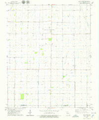
1978 Map of Hills Store
USGS Topo · Published 1979About this map
Hills Store serves as a central landmark for this rural landscape in the late 1970s, where the agricultural grid of Stoddard and New Madrid counties is defined by drainage and historical transport routes. The eastern edge of the quadrangle follows the Castor River, while the interior is marked by an Old Railroad Grade passing near La Valle. This area, managed in part by the Missouri Department of Natural Resources, reveals a settlement pattern tied to small crossroads and family legacies, evidenced by Stones Chapel Cem, Barker Cem, and Cravins Cem.
Find a feature on this map
19 named features on this map. Tap any name to fly to it.
Don’t see what you’re looking for? This feature index may not catch every label — zoom into the map to look around manually.
Map Details
Editions of this 1978 Hills Store Map
This is the sole edition of this map. No revisions or reprints were ever made.
Other maps of this area

1931 · Sikeston
USGS Topo · 1:62,500

1934 · Bloomfield
USGS Topo · 1:62,500

1934 · Sikeston
USGS Topo · 1:62,500

1939 · Bloomfield
USGS Topo · 1:62,500

1939 · Sikeston
USGS Topo · 1:62,500

1939 · New Madrid
USGS Topo · 1:62,500

1940 · Malden
USGS Topo · 1:62,500

1949 · Bloomfield
USGS Topo · 1:62,500

1954 · New Madrid
USGS Topo · 1:62,500

1956 · Malden
USGS Topo · 1:62,500