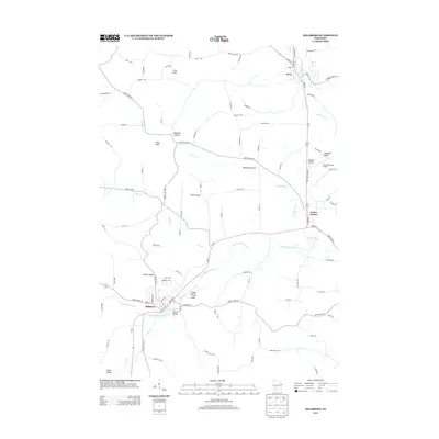
2013 Map of Hillsboro
USGS Topo · Published 2013About this map
Elroy and Hillsboro anchor this 2013 survey of Juneau County, Wisconsin, where the headwaters of the Baraboo River and the W Br Baraboo River carve through a landscape of distinctive bluffs and valleys. The settlement pattern follows these watercourses and the higher ground between them, including smaller communities like Union Center and Dutch Valley. The terrain is characterized by prominent landmarks such as The Pinnacle, Kimballs Bluff, and Tinkers Bluff, which rise above the surrounding agricultural lands. Local aviation is represented by Joshua Sanford Field Airport near Hillsboro and the Elroy Municipal Airport to the northeast. Hydrological features like Hillsboro Pond 76 and Seymour Cr illustrate the drainage network that historically influenced the placement of early roads and townsites in this portion of the Driftless Area.
Find a feature on this map
81 named features on this map. Tap any name to fly to it.
Don’t see what you’re looking for? This feature index may not catch every label — zoom into the map to look around manually.
Map Details
Editions of this 2013 Hillsboro Map
This is the sole edition of this map. No revisions or reprints were ever made.
Other maps of this area

1919 · Kendall
USGS Topo · 1:62,500

1921 · Mauston
USGS Topo · 1:62,500

1921 · Kendall
USGS Topo · 1:62,500

1927 · Hillsboro
USGS Topo · 1:62,500

1956 · Reedsburg
USGS Topo · 1:62,500

1958 · La Crosse
USGS Topo · 1:250,000

1961 · La Crosse
USGS Topo · 1:250,000

1962 · Kendall
USGS Topo · 1:62,500

1962 · Mauston
USGS Topo · 1:62,500

1965 · La Crosse
USGS Topo · 1:250,000