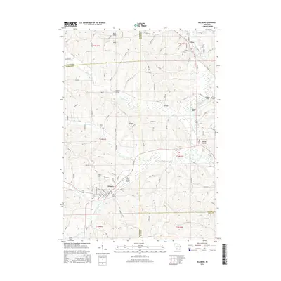
2016 Map of Hillsboro
USGS Topo · Published 2016About this map
Hillsboro and Elroy anchor this 2016 survey of western Wisconsin, where the headwaters of the Baraboo River wind through the Driftless Area terrain. The landscape is defined by its dramatic topography, featuring prominent landmarks like The Pinnacle, Tinkers Bluff, and Pikes Peak. Local history is preserved in the numerous rural burial grounds such as Hills Prairie Cem and Mount Vernon Cem, while the small settlement of Dutch Valley sits tucked along the southern hills. Modern infrastructure including Joshua Sanford Field and the Elroy Municipal Airport serves the region, alongside the 400 State Trl which repurposes old rail corridors for recreation. The map meticulously records the intersection of four counties—Juneau, Monroe, Sauk, and Vernon—demonstrating how political boundaries follow the ridge-and-valley patterns of the Seymour Cr and South Branch Creek drainage basins.
Find a feature on this map
122 named features on this map. Tap any name to fly to it.
Don’t see what you’re looking for? This feature index may not catch every label — zoom into the map to look around manually.
Map Details
Editions of this 2016 Hillsboro Map
This is the sole edition of this map. No revisions or reprints were ever made.
Other maps of this area

1919 · Kendall
USGS Topo · 1:62,500

1921 · Mauston
USGS Topo · 1:62,500

1921 · Kendall
USGS Topo · 1:62,500

1927 · Hillsboro
USGS Topo · 1:62,500

1956 · Reedsburg
USGS Topo · 1:62,500

1958 · La Crosse
USGS Topo · 1:250,000

1961 · La Crosse
USGS Topo · 1:250,000

1962 · Kendall
USGS Topo · 1:62,500

1962 · Mauston
USGS Topo · 1:62,500

1965 · La Crosse
USGS Topo · 1:250,000