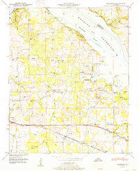
1951 Map of Hillsboro
USGS Topo · Published 1951About this map
Hillsboro and Wheeler anchor the landscape of northern Lawrence County in the mid-20th century, situated just south of the Wheeler Reservoir and the Tennessee River. This map reveals a high density of rural homesteads and family burial grounds, such as Newman Cem, Graves Cem, and Swoope Cem, indicating a deeply rooted community structure before later modernization. The local economy and travel patterns are defined by the Southern Railway and the Joe Wheeler Highway, which run parallel through the southern half of the quadrangle.
Find a feature on this map
53 named features on this map. Tap any name to fly to it.
Don’t see what you’re looking for? This feature index may not catch every label — zoom into the map to look around manually.
Map Details
Editions of this 1951 Hillsboro Map
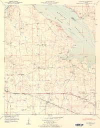
2 editions found
Other maps of this area

1914 · Rogersville
USGS Topo · 1:48,000

1916 · Rogersville
USGS Topo · 1:62,500

1936 · Caddo
USGS Topo · 1:24,000

1936 · Thorntontown
USGS Topo · 1:24,000

1936 · Stewart Cross Roads
USGS Topo · 1:24,000

1936 · Courtland
USGS Topo · 1:24,000

1936 · Ripley
USGS Topo · 1:24,000

1936 · Trinity
USGS Topo · 1:24,000

1936 · Hillsboro
USGS Topo · 1:24,000

1936 · Cairo
USGS Topo · 1:24,000