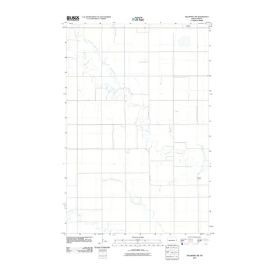
2011 Map of Hillsboro NW
USGS Topo · Published 2011About this map
The meandering course of the Goose River and its tributary, the North Branch Goose River, dominates this section of the Red River Valley in eastern North Dakota. The landscape reflects a deeply ingrained agricultural pattern, where section-line roads and drainage infrastructure like Norway Drain Number 38 manage the prairie's water table. For local historians and genealogists, the map identifies two significant sites: Arnegard Cemetery in the southeast and Carlson Cemetery at the northern boundary. Transportation is defined by a grid of rural routes, including County Hwy-10 and County Hwy-11, which connect the scattered farmsteads across this fertile plain. The southern portion of the quadrangle includes the headwaters of the North Branch Elm River, showing the subtle drainage divide characteristic of Traill County's flat terrain.
Find a feature on this map
9 named features on this map. Tap any name to fly to it.
Don’t see what you’re looking for? This feature index may not catch every label — zoom into the map to look around manually.
Map Details
Editions of this 2011 Hillsboro NW Map
This is the sole edition of this map. No revisions or reprints were ever made.
Other maps of this area

1918 · Kelso
USGS Topo · 1:62,500

1943 · Kelso
USGS Topo · 1:62,500

1952 · Grand Forks
USGS Topo · 1:250,000

1956 · Grand Forks
USGS Topo · 1:250,000

1963 · Hillsboro
USGS Topo · 1:24,000

1963 · Kelso
USGS Topo · 1:24,000

1966 · Grand Forks
USGS Topo · 1:250,000

1967 · Mayville South
USGS Topo · 1:24,000

1967 · Blanchard
USGS Topo · 1:24,000
1967 · Hillsboro NW
USGS Topo · 1:24,000