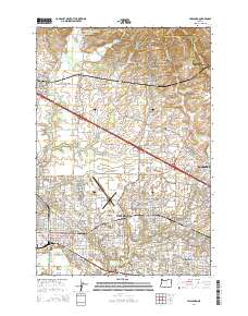
2014 Map of Hillsboro
USGS Topo · Published 2014About this map
Hillsboro serves as the focal point of this mapping, where the Tualatin River basin meets the foothills of the Tualatin Mountains. The transition from rural to urban is evident, with agricultural heritage preserved in sites like the Old Scotch Cem and W Union Cem contrasted against the modern infrastructure of the Portland-Hillsboro Airport and the Hillsboro Central-Transit Center. The southern reach is dominated by the Jackson Bottom wetlands and several reservoirs including Teufel Reservoir and Bastion Reservoir, which define the local drainage into Dairy Cr. Historically significant settlements such as Helvetia, West Union, and Glencoe ring the valley floor, connected by a dense network of roads that follow early land claims and topographic contours like Pumpkin Ridge.
Find a feature on this map
235 named features on this map. Tap any name to fly to it.
Don’t see what you’re looking for? This feature index may not catch every label — zoom into the map to look around manually.
Map Details
Editions of this 2014 Hillsboro Map
This is the sole edition of this map. No revisions or reprints were ever made.
Other maps of this area

1915 · Hillsboro
USGS Topo · 1:62,500

1916 · Tualatin
USGS Topo · 1:62,500

1918 · Hillsboro
USGS Topo · 1:62,500

1939 · Tualatin
USGS Topo · 1:62,500

1940 · Tualatin
USGS Topo · 1:62,500

1940 · Hillsboro
USGS Topo · 1:62,500

1941 · Gales Creek
USGS Topo · 1:62,500

1941 · Yamhill
USGS Topo · 1:62,500

1942 · Yamhill
USGS Topo · 1:62,500

1948 · Vancouver
USGS Topo · 1:250,000