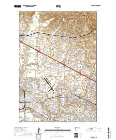
2020 Map of Hillsboro
USGS Topo · Published 2020About this map
Hillsboro serves as the focal point of this 2020 landscape, where the suburban grid meets the agricultural and industrial reaches of the Tualatin Valley. The Washington County Courthouse and the Main Street Bridge anchor the historic civic center, while the expansive Portland-Hillsboro Airport dominates the northern edge of the city. Beyond the urban core, the map reveals a transition into the foothills of the Tualatin Mountains and Pumpkin Ridge, where smaller communities like Helvetia and West Union maintain their distinct identities. This sheet provides significant detail for researchers, showing the location of the Old Scotch Cem, West Union Cem, and Valley Memorial Park Cem, alongside industrial features like the Jackson Quarry. The hydrology of the area is complex, ranging from the managed waters of the Jackson Reservoir and Vanderzanden Reservoir to the natural wetlands of Jackson Bottom.
Find a feature on this map
270 named features on this map. Tap any name to fly to it.
Don’t see what you’re looking for? This feature index may not catch every label — zoom into the map to look around manually.
Map Details
Editions of this 2020 Hillsboro Map
This is the sole edition of this map. No revisions or reprints were ever made.
Other maps of this area

1915 · Hillsboro
USGS Topo · 1:62,500

1916 · Tualatin
USGS Topo · 1:62,500

1918 · Hillsboro
USGS Topo · 1:62,500

1939 · Tualatin
USGS Topo · 1:62,500

1940 · Tualatin
USGS Topo · 1:62,500

1940 · Hillsboro
USGS Topo · 1:62,500

1941 · Gales Creek
USGS Topo · 1:62,500

1941 · Yamhill
USGS Topo · 1:62,500

1942 · Yamhill
USGS Topo · 1:62,500

1948 · Vancouver
USGS Topo · 1:250,000