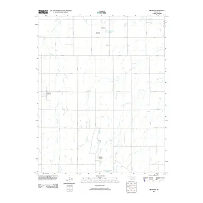
2010 Map of Hillsdale
USGS Topo · Published 2010About this map
Hillsdale serves as the primary settlement hub within this Garfield County landscape, characterized by a regular grid of section-line roads like N2820 Rd and E0310 Rd. The terrain is defined by a series of parallel drainage systems, including Sand Creek and Ninemile Creek, which flow generally southward toward the Ninemile Canyons. This 2010 survey highlights a sophisticated water management network in the rural northern reaches, marked by several numbered reservoirs and dams such as the Oknoname 04705 Reservoir and Oknoname 04704 Dam. These features illustrate the conversion of prairie drainages into controlled water sources for local agriculture and livestock. In the eastern portion of the quadrangle, Wild Horse Creek adds further complexity to the hydrologic pattern, showing the typical Oklahoma prairie landscape where small watercourses have been subtly modified by human engineering.
Find a feature on this map
26 named features on this map. Tap any name to fly to it.
Don’t see what you’re looking for? This feature index may not catch every label — zoom into the map to look around manually.
Map Details
Editions of this 2010 Hillsdale Map
This is the sole edition of this map. No revisions or reprints were ever made.
Other maps of this area

1955 · Enid West
USGS Topo · 1:24,000

1955 · Enid East
USGS Topo · 1:24,000

1955 · Enid
USGS Topo · 1:250,000

1955 · Woodward
USGS Topo · 1:250,000

1956 · Enid
USGS Topo · 1:62,500

1956 · Ringwood
USGS Topo · 1:62,500

1958 · Enid
USGS Topo · 1:250,000

1958 · Woodward
USGS Topo · 1:250,000

1968 · Hillsdale
USGS Topo · 1:24,000

1968 · Kremlin
USGS Topo · 1:24,000