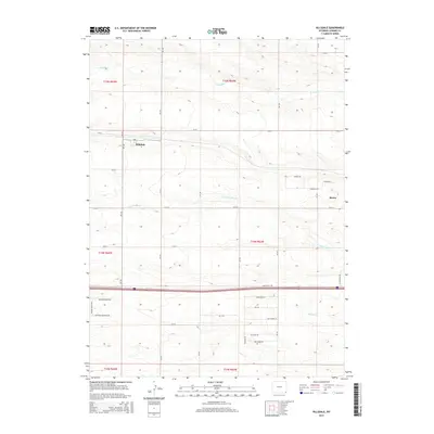
2015 Map of Hillsdale
USGS Topo · Published 2015About this map
Hillsdale and the western outskirts of Burns anchor this high-plains landscape in Laramie County, Wyoming. The terrain is defined by the ephemeral flow of several waterways, including Lodgepole Cr in the north and the N Fork Muddy Cr and Muddy Cr systems that drain toward the southeast. This contemporary survey illustrates the area's transition into residential enclaves and rural subdivisions, evidenced by street names such as Antelope Meadows Dr, Meadow Ridge Way, and Canvasback Ln.
Find a feature on this map
38 named features on this map. Tap any name to fly to it.
Don’t see what you’re looking for? This feature index may not catch every label — zoom into the map to look around manually.
Map Details
Editions of this 2015 Hillsdale Map
This is the sole edition of this map. No revisions or reprints were ever made.
Other maps of this area

1911 · Cheyenne
USGS Topo · 1:125,000

1914 · Cheyenne
USGS Topo · 1:125,000

1954 · Cheyenne
USGS Topo · 1:250,000

1958 · Cheyenne
USGS Topo · 1:250,000

1963 · Arcola
USGS Topo · 1:24,000

1963 · Burns
USGS Topo · 1:24,000

1963 · Pole Creek Ranch SE
USGS Topo · 1:24,000

1963 · Durham
USGS Topo · 1:24,000

1963 · Midway SE
USGS Topo · 1:24,000

1963 · Carpenter
USGS Topo · 1:24,000