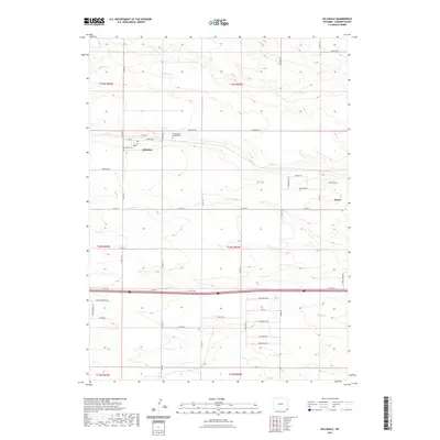
2021 Map of Hillsdale
USGS Topo · Published 2021About this map
Hillsdale and Burns define the residential hubs of this Laramie County landscape, where the high plains are carved by the western reaches of Lodgepole Cr and Muddy Cr. The map highlights a community anchored by agriculture and transportation, with the established corridor of Railroad Rd running parallel to the tracks north of Main St. For local historians and genealogists, the inclusion of Hillsdale Cem and the Gethsemane Gardens Cem provides specific points of interest for family research. The southern portion of the quadrangle is bisected by the I-80 Svc Rd, showing the modern infrastructure that connects these small settlements to the broader region. Numerous country roads, such as Co RD 215 and Co RD 213, form a strict grid across the prairie, reflecting the enduring legacy of the Public Land Survey System in Wyoming.
Find a feature on this map
40 named features on this map. Tap any name to fly to it.
Don’t see what you’re looking for? This feature index may not catch every label — zoom into the map to look around manually.
Map Details
Editions of this 2021 Hillsdale Map
This is the sole edition of this map. No revisions or reprints were ever made.
Other maps of this area

1911 · Cheyenne
USGS Topo · 1:125,000

1914 · Cheyenne
USGS Topo · 1:125,000

1954 · Cheyenne
USGS Topo · 1:250,000

1958 · Cheyenne
USGS Topo · 1:250,000

1963 · Arcola
USGS Topo · 1:24,000

1963 · Burns
USGS Topo · 1:24,000

1963 · Pole Creek Ranch SE
USGS Topo · 1:24,000

1963 · Durham
USGS Topo · 1:24,000

1963 · Midway SE
USGS Topo · 1:24,000

1963 · Carpenter
USGS Topo · 1:24,000