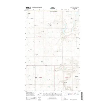
2014 Map of Hillside Colony
USGS Topo · Published 2014About this map
The communal settlements of Hillside Colony and Rim Rock Colony anchor this landscape in northern Toole County, situated just south of the international border with the United States of America. This high plains terrain is defined by an intricate network of drainage features known as coulees, which channel seasonal water across the prairie. Notable among these are Rocky Ridge Coulee, Buckley Coulee, and Farrell Coulee, which create significant relief in the otherwise steady topography.
Find a feature on this map
37 named features on this map. Tap any name to fly to it.
Don’t see what you’re looking for? This feature index may not catch every label — zoom into the map to look around manually.
Map Details
Editions of this 2014 Hillside Colony Map
This is the sole edition of this map. No revisions or reprints were ever made.
Other maps of this area

1909 · Cut Bank
USGS Topo · 1:125,000

1912 · Cut Bank
USGS Topo · 1:125,000

1939 · Sunburst
USGS Topo · 1:62,500

1954 · Shelby
USGS Topo · 1:250,000

1958 · Shelby
USGS Topo · 1:250,000

1960 · Cut Bank
USGS Topo · 1:250,000

1963 · Cut Bank
USGS Topo · 1:250,000

1964 · Cut Bank
USGS Topo · 1:250,000
1968 · Hillside Colony
USGS Topo · 1:24,000
1968 · Mountain View School
USGS Topo · 1:24,000