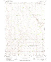
1979 Map of Hillside
USGS Topo · Published 1980About this map
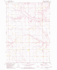
Hillside sits at the heart of this agricultural landscape in the late 1970s, where the grid of sections defines the social and physical geography of Douglas and Davison Counties. The area is marked by a deep-rooted network of country institutions, including St John Ch and several burial grounds such as Friedhof Cem and Roberts Chapel Cem. These features, along with the Washington No 1 Sch, suggest a long-established rural community organized around small townships like Baker and Washington. The South Fork Twelvemile Creek meanders through the northeast, providing a natural break in the otherwise orderly section lines. Economic and recreational needs are represented by a localized Gravel Pit and the Roadside Park near the southern edge, reflecting the steady rhythm of prairie life during this era.
Find a feature on this map
15 named features on this map. Tap any name to fly to it.
Don’t see what you’re looking for? This feature index may not catch every label — zoom into the map to look around manually.
Map Details
Editions of this 1979 Hillside Map
This is the sole edition of this map. No revisions or reprints were ever made.
Other maps of this area

1899 · Mitchell
USGS Topo · 1:125,000

1955 · Mitchell
USGS Topo · 1:250,000

1959 · Mitchell
USGS Topo · 1:250,000

1979 · Delmont
USGS Topo · 1:24,000
1979 · Delmont NE
USGS Topo · 1:24,000
1979 · Delmont SE
USGS Topo · 1:24,000
1979 · Armour
USGS Topo · 1:24,000

1980 · Corsica Lake
USGS Topo · 1:24,000

1980 · Old Stickney Lake
USGS Topo · 1:24,000
1980 · Mitchell SW
USGS Topo · 1:24,000