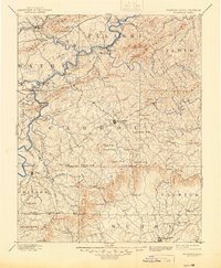
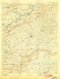
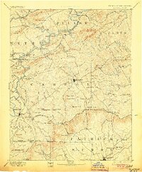
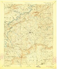
1896 Map of Hillsville
USGS Topo · Published 1945About this map
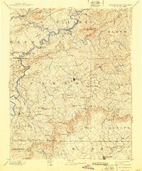
The New River carves a winding path through the Blue Ridge foothills in this 1880s-era survey, revealing an industrial landscape defined by early iron and lead works. Operations such as Barren Spring Furnace, Boom Furnace, and Ivanhoe Furnace dot the riverbanks, while the presence of Lead Mines and Radford Furnace highlights the mineral extraction that drove the local economy. At Jackson Ferry, a crossing connects the rugged terrain of Wythe and Carroll counties, serving as a vital link before the widespread construction of modern bridges.
Find a feature on this map
148 named features on this map. Tap any name to fly to it.
Don’t see what you’re looking for? This feature index may not catch every label — zoom into the map to look around manually.
Map Details
Editions of this 1896 Hillsville Map
7 editions found


Other maps of this area

1887 · Pocahontas
USGS Topo · 1:125,000

1889 · Hillsville
USGS Topo · 1:125,000

1889 · Wytheville
USGS Topo · 1:125,000

1889 · Wilkesboro
USGS Topo · 1:125,000

1890 · Dublin
USGS Topo · 1:125,000

1890 · Christiansburg
USGS Topo · 1:125,000

1891 · Pocahontas
USGS Topo · 1:125,000

1891 · Dublin
USGS Topo · 1:125,000

1891 · Wilkesboro
USGS Topo · 1:125,000

1891 · Yadkinville
USGS Topo · 1:125,000