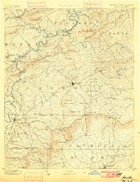
1896 Map of Hillsville
USGS Topo · Published 1900About this map
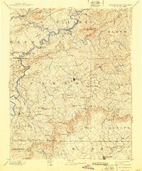
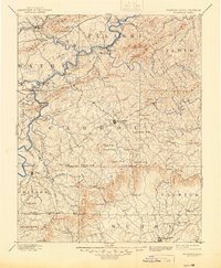
Hillsville serves as the central hub of this late-19th-century reconnaissance survey, which captures the industrial landscape of the Virginia-North Carolina borderlands before modern infrastructure reshaped the Blue Ridge. The region's early economic engine is visible through a concentration of ironworks such as Radford Furnace, Barren Spg. Furnace, and Ivanhoe Furnace, alongside the Lead Mines near the Norfolk and Western RR. Transportation in this era relied heavily on the New River's crossings, documented here through a series of named points including Jackson Ferry, Howards Ferry, and Thorne Ferry. To the south, the map details the transition into the Fisher River basin across the Virginia North Carolina Boundary Line, where remote mountain gaps like Fancy Gap and Piper Gap provided essential passage through the high ridges of Poplar Camp Mt. and the surrounding knobs.
Find a feature on this map
164 named features on this map. Tap any name to fly to it.
Don’t see what you’re looking for? This feature index may not catch every label — zoom into the map to look around manually.
Map Details
Editions of this 1896 Hillsville Map
7 editions found

Other maps of this area

1887 · Pocahontas
USGS Topo · 1:125,000

1889 · Hillsville
USGS Topo · 1:125,000

1889 · Wytheville
USGS Topo · 1:125,000

1889 · Wilkesboro
USGS Topo · 1:125,000

1890 · Dublin
USGS Topo · 1:125,000

1890 · Christiansburg
USGS Topo · 1:125,000

1891 · Pocahontas
USGS Topo · 1:125,000

1891 · Dublin
USGS Topo · 1:125,000

1891 · Wilkesboro
USGS Topo · 1:125,000

1891 · Yadkinville
USGS Topo · 1:125,000