
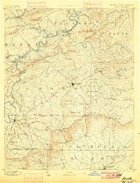
1896 Map of Hillsville
USGS Topo · Published 1896About this map
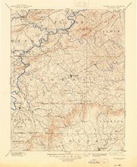
Hillsville serves as the central hub of this late-nineteenth-century study, situated amidst a landscape defined by the early industrial activity of southwest Virginia. The map documents a corridor of iron and mineral production, evidenced by the cluster of furnaces such as Ivanhoe Furnace, Radford Furnace, and Boom Furnace, alongside the Lead Mines near the river. Movement through this difficult terrain relied on a network of named river crossings, including Jackson Ferry, Thorne Ferry, and Dixon Ford, many of which have been superseded by modern infrastructure.
Find a feature on this map
155 named features on this map. Tap any name to fly to it.
Don’t see what you’re looking for? This feature index may not catch every label — zoom into the map to look around manually.
Map Details
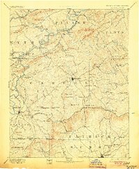
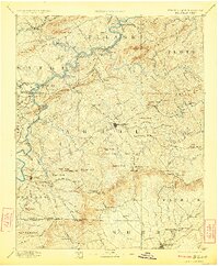
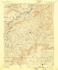
Editions of this 1896 Hillsville Map
7 editions found

Other maps of this area

1887 · Pocahontas
USGS Topo · 1:125,000

1889 · Hillsville
USGS Topo · 1:125,000

1889 · Wytheville
USGS Topo · 1:125,000

1889 · Wilkesboro
USGS Topo · 1:125,000

1890 · Dublin
USGS Topo · 1:125,000

1890 · Christiansburg
USGS Topo · 1:125,000

1891 · Pocahontas
USGS Topo · 1:125,000

1891 · Dublin
USGS Topo · 1:125,000

1891 · Wilkesboro
USGS Topo · 1:125,000

1891 · Yadkinville
USGS Topo · 1:125,000