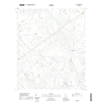
2020 Map of Hilltonia
USGS Topo · Published 2020About this map
Brier Creek winds through the central corridor of this Georgia landscape, defining the boundary between Burke and Screven counties. The area is characterized by a network of rural settlements and agricultural crossroads, including Sardis, Millhaven, and Hiltonia. For genealogists and local historians, the sheet preserves the locations of several community burial grounds, such as Mount Pleasant Cem, Saint Paul Cem, and Hurst Cem, often situated near older road alignments like Roberts Bridge Rd and Hurst Church Rd. The hydraulic history of the region is evident in named water bodies like Hills Millpond, Millhaven Pond, and Charlie Pond, which suggest a legacy of local milling and water management. Transportation is anchored by historic routes such as Sunbury Rd and the Hiltonia-Perkins Rd, connecting these small townships across the coastal plain.
Find a feature on this map
64 named features on this map. Tap any name to fly to it.
Don’t see what you’re looking for? This feature index may not catch every label — zoom into the map to look around manually.
Map Details
Editions of this 2020 Hilltonia Map
This is the sole edition of this map. No revisions or reprints were ever made.
Other maps of this area

1920 · Ellenton
USGS Topo · 1:48,000

1920 · Hilltonia
USGS Topo · 1:62,500

1920 · Millen
USGS Topo · 1:62,500

1920 · Greens Cut
USGS Topo · 1:62,500

1921 · Ellenton
USGS Topo · 1:62,500

1943 · Hilltonia
USGS Topo · 1:62,500

1943 · Greens Cut
USGS Topo · 1:62,500

1943 · Millen
USGS Topo · 1:62,500

1943 · Augusta East
USGS Topo · 1:125,000

1943 · Millen
USGS Topo · 1:125,000