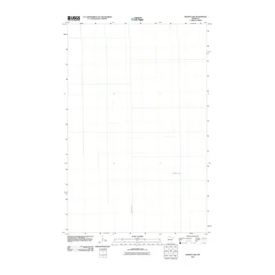
2010 Map of Hilman Lake
USGS Topo · Published 2010About this map
Hilman Lake lies at the center of this sparse landscape in Beltrami County, representing the characteristic wetland and glacial terrain of northern Minnesota. This 2010 survey illustrates the extensive human intervention in the region's hydrology through features like Ditch Number Thirty, which cuts across the terrain to manage water flow. The map reflects a predominantly natural area with a geometric grid of local roads and property boundaries, typical of the region’s development in the early 21st century. Researchers interested in northern water management systems will find the precise placement of these ditches and small water bodies informative for understanding the local environment and land use patterns.
Find a feature on this map
2 named features on this map. Tap any name to fly to it.
Don’t see what you’re looking for? This feature index may not catch every label — zoom into the map to look around manually.
Map Details
Editions of this 2010 Hilman Lake Map
This is the sole edition of this map. No revisions or reprints were ever made.
Other maps of this area

1919 · G
USGS Topo · 1:62,500

1919 · Fox
USGS Topo · 1:62,500

1919 · Ponemah
USGS Topo · 1:62,500

1919 · Knutson
USGS Topo · 1:62,500

1943 · Ponemah
USGS Topo · 1:62,500

1954 · Roseau
USGS Topo · 1:250,000

1957 · Roseau
USGS Topo · 1:250,000

1958 · Roseau
USGS Topo · 1:250,000
1973 · Waskish NW
USGS Topo · 1:24,000
1973 · Chase Brook
USGS Topo · 1:24,000