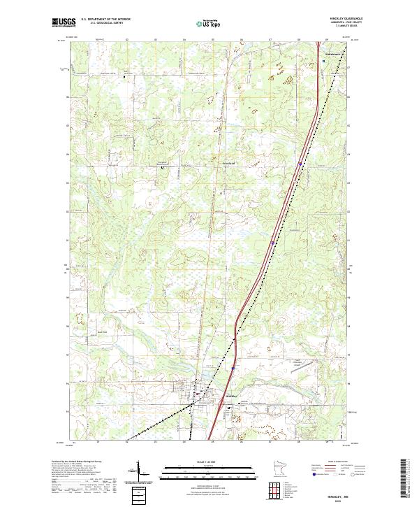
2022 Map of Hinckley
USGS Topo · Published 2022About this map
Grindstone River and its north and south branches anchor the southern portion of this Pine County landscape, where the city of Hinckley serves as a primary hub. The map captures the area's transition from the dense residential grid of the town center to the outlying small settlements of Friesland and Bush Field. To the north, the terrain is defined by a network of drainage systems like Friesland Ditch and natural watercourses including Deer Cr and Skunk Cr. Genealogists will find several burial sites preserved here, including Dell Grove Cem, Evergreen Memorial Park, and the Lutheran Memorial Cem. Transportation history is evident in the alignment of Old Military Rd and the presence of the Field of Dreams Airport east of the main settlement.
Find a feature on this map
84 named features on this map. Tap any name to fly to it.
Don’t see what you’re looking for? This feature index may not catch every label — zoom into the map to look around manually.
Map Details
Editions of this 2022 Hinckley Map
This is the sole edition of this map. No revisions or reprints were ever made.
Other maps of this area

1953 · Duluth
USGS Topo · 1:250,000

1953 · Stillwater
USGS Topo · 1:250,000

1955 · Stillwater
USGS Topo · 1:250,000

1958 · Stillwater
USGS Topo · 1:250,000

1958 · Duluth
USGS Topo · 1:250,000

1961 · Sandstone
USGS Topo · 1:62,500

1961 · Brook Park
USGS Topo · 1:62,500

1961 · Pine City
USGS Topo · 1:62,500

1965 · Stillwater
USGS Topo · 1:250,000

1968 · Giese
USGS Topo · 1:24,000